King's College London
The Idea of Lebanon
Rights, Violent Caesuras, and Sequels of Injury
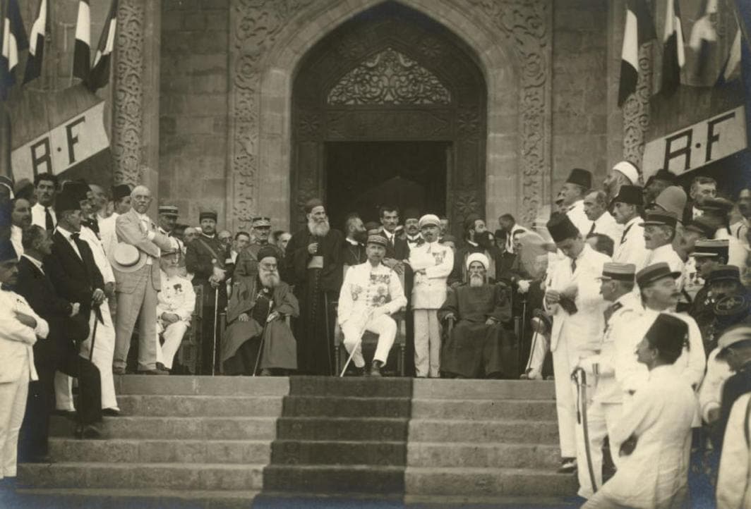
The present in Lebanon retains the imprint of a past which is not yet past, but rather one which is lived, reproduced, and recalibrated on a daily basis. Authored and curated by Madonna Kalousian, this section of the exhibition captures the ramifications of this pervasive embeddedness of multiple layers of meaning from the past and the present as these manifest in modern-day Lebanon. It paints a picture in which the administrative, juridical, geographical, and demographic contours of what becomes Lebanon, particularly as undefined and redefined by colonial rule, continue today to plunge the country into a succession of episodes of harm, injury, and injustice.
It does so by building on an understanding of the idea of Lebanon at various stages of its history, from the late Ottoman times and the French Mandate to the post-independence era and the present-day regional escalation of violence inflicting further harm onto the post-civil war reality of a population whose injuries are not only yet to heal, but also continue to multiply.
Mount Lebanon: Rifts and ‘Blood Ties’
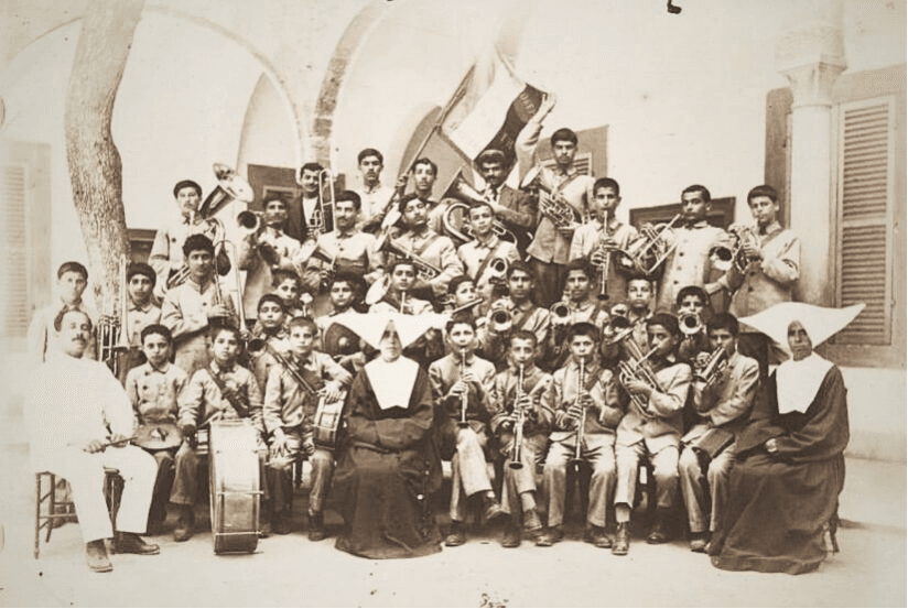
Widespread outbreaks of Druze-Christian communal violence, followed by a series of massacres against the Maronites, drew a French-led international military intervention to establish what became Mount Lebanon in 1860, appoint a Christian governor, and build a number of universities, schools, and orphanages for the protection of Christians, including today’s Université Saint-Joseph de Beyrouth and Orphelinat St Joseph.
Having redefined Mount Lebanon’s geographical and administrative contours, “the Maronite patriarch, his bishops, and French Catholic circles in particular echoed one another’s myths about the inviolable ‘privileges and traditions’ of the Maronite community and the historic connections – if not ‘blood ties’ – between the latter and the French. Many Lebanese nationalists were later to accept as a given the chimera of Christian entitlement to Mt. Lebanon.” (Hanssen and Safieddine 2019, 18)
- Centre des Archives diplomatiques du ministère des Affaires étrangères (the Centre of the Diplomatic Archives of the French Ministry for Europe and Foreign Affairs)
- Title: Beyrouth, la musique de l'orphelinat de Saint-Joseph
- Date: 1921
- Image Number: A003966
Protocole et règlement relatifs à l’administration du Liban
Protocol and Regulations Relating to the Administration of Lebanon
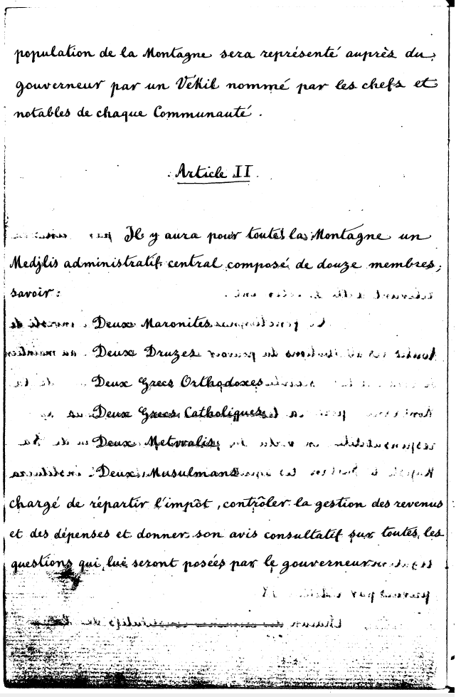
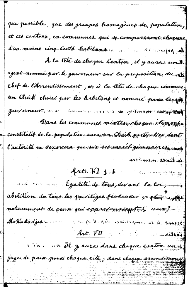
The French-led international military intervention was ratified as part of a convention between Great Britain, Austria, France, Prussia, Russia, and Turkey, signed in Paris on June 9, 1860, under the title “Protocole et règlement relatifs à l’administration du Liban”. The convention introduced a number of formative measures through which to govern Mount Lebanon and reorganise its various populations and confessional denominations. These measures included the establishment of a new sect-based administrative council, as described in
In addition to the sect-based administrative council for Mount Lebanon, the convention also re-introduced a sect-based court system, mirroring an Ottoman structure of a millet system, as described in
While sect-based councils governed the administrative and juridical affairs of Mount Lebanon, French troops were deployed along the roads between Beirut and Damascus, and Tripoli and Saida in order to control the borders of this autonomous territory, as laid out in
Document Number: TRA18610012
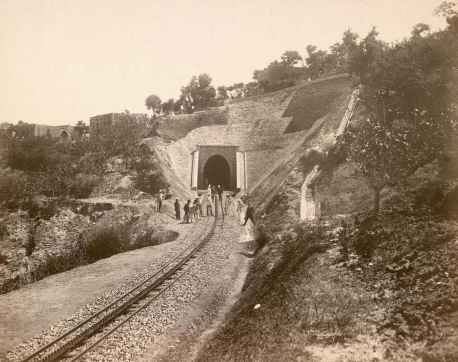
From 1882, French troops also oversaw the construction of the now-abandoned railway connecting Beirut and Damascus. The tracks, which were inaugurated in 1895, ran in parallel with the very road along which French troops were deployed, as well as with the borderline separating the Maronite north from the Druze south, as shown in the following 1860 map by Francois Garnier.
- Centre des Archives diplomatiques du ministère des Affaires étrangères
- Title: Tunnel d'Araya (chemin de fer de Beyrouth à Damas) 1895
- Photographer: Adrien Bonfils
- Image Number: A008135
- Series: P- Levant
Mandating the Maronite-Druze Frontier
This map showing the eastern Mediterranean region is based, on official documents published in France shortly after the Paris conference of 1860. It was produced by Francois Garnier, lieutenant in the French Army, ‘inspector of indigenous affairs’, and member of the Geographical Society of Paris who, in 1870, was awarded the ‘Patron’s Medal’ by London’s Royal Geographical Society. At the very centre of this map sits the territory of Mount Lebanon, divided following the Paris treaty into a Maronite north and a Druze south.
Zoom-in on Lebanon to view the division of the territory of Mount Lebanon as introduced by the Paris conference.
Sectarian Cartography
Titled Carte du Liban d'après les reconnaissances de la brigade topographique du corps expéditionnaire de Syrie en 1860-1861, this map of Lebanon is based on the reconnaissance of the topographical brigade of the Syrian expedition force of 1860-1861. It was put together, as shown here, by Captain Charles Gélis of the depot de la guerre, the ‘war depot', who led the international military intervention of 1860. The table included with this map builds on the administrative organisation of Lebanon under the ottoman rule, as detailed in the Ottoman Yearbook page shown earlier in this exhibition. More importantly, however, the table divides Lebanon on the basis of sect and informs the proclamation of what later becomes Grand Liban under the French Mandate.